

Posts from July 26th, 2024
Seth Brent Blog
 RSS Feed
Subscribe and receive email notifications of new blog posts.
RSS Feed
Bend Makes Another List | 3 Posts
Bend Oregon Real Estate | 2 Posts
Bend Oregon Real Estate Trends | 65 Posts
Bend Premier Real Estate Listings | 1 Posts
Bend Premier Real Estate News | 25 Posts
Bend Real Estate General Information | 134 Posts
Bend's Best Bites | 1 Posts
Central Oregon Real Estate | 23 Posts
Central Oregon Real Estate Market Trends | 11 Posts
Fun Real Estate Facts | 1 Posts
Great Oregon Hikes | 58 Posts
Happenings in Bend | 7 Posts
Luxury Real Estate | 15 Posts
Neighborhoods to See in Bend Oregon | 8 Posts
Newsletters | 36 Posts
Places to See in Central Oregon | 19 Posts
Redmond Oregon Real Estate Trends | 7 Posts
Uncategorized | 4 Posts
Why We Love Central Oregon | 19 Posts
July
26
26
Hike Tam McArthur Rim to Broken Top For the Views and Experience
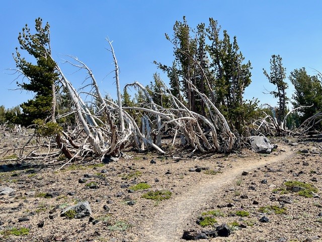
Besides the lake, many will take the 5.3 mile round trip hike (permit required) above the lake to Tam McArthur Rim, gaining over 1200 feet in elevation to reach the rim. Typically the views from this spot are clear from Broken Top and the Three Sisters all the way to Mt. Hood. However, in recent years summer forest fires have added haze and smoke often obstructing the views.
 |
 |
On July 20, 2024, the day started with a slight haze but by the end of the day, the smoke from forest fires settled into the area. However, the hike to Tam McArthur Rim was uneventful with just a handful of people also taking the same trek.
 |
 |
 |
 |
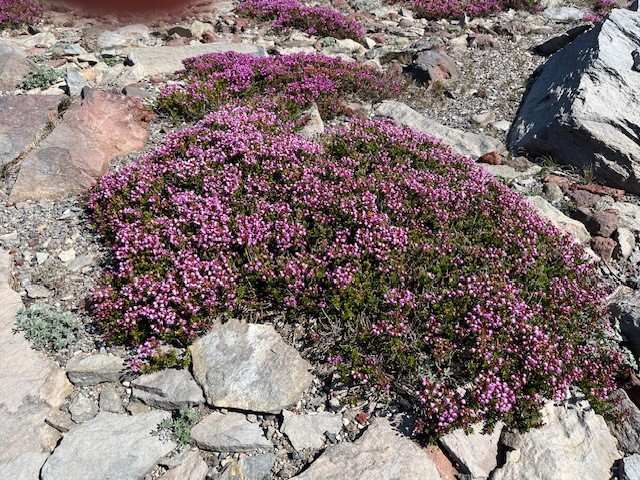
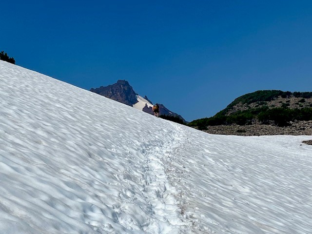
Past Tam McArthur Rim, the unmaintained trail to Broken Hand and Broken Top had abundant wildflowers for this alpine area as well as heavier snow patches than experienced in past years. The approach to Broken Hand involves scrambling over rocks and climbing several cinder ridges before reaching this rugged, rocky prominence. To pass it this July involved either detouring around the rocky base, hiking over snow fields, or trekking directly over snow on Broken Hand's westside. Either way people needed to be careful to avoid falling and sliding down the snowy hill. The majority of people appeared to be going directly over the snowy side of Broken Hand.
 |
 |
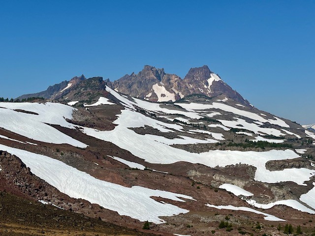
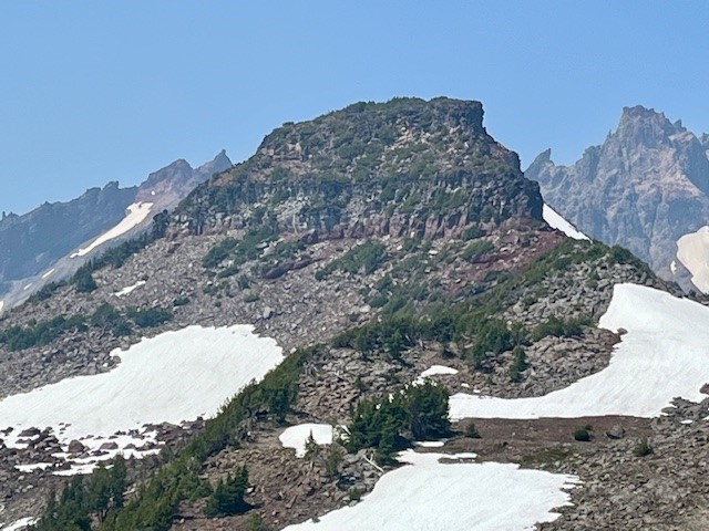
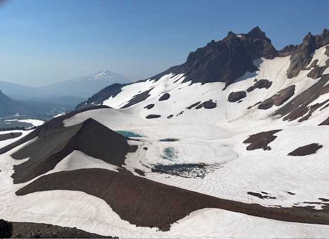
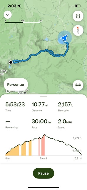
Past Broken Hand, there is a hill to climb to reach a fabulous view point. From here, the cragged top and colorful flanks of Broken Top are very visible (along with ski tracks from recent, ambitious past visitors who must have either rope climbed to the top of Broken Top and rappelled down or else made their was up the very steep side of the mountain to the top of the snow patch and skied down to the lake) as well as snow and ice covered No Name Lake. Besides Broken Top, the Three Sisters are very big and impressive from this view point and Mt. Bachelor and Tumalo Mountain visible in the hazy distance. The hike back to the trail head goes fairly fast as it is mostly downhill. All in all, the entire hike is under eleven miles and about 2150 feet of elevation gain.
 |
 |
Privacy Policy / DMCA Notice / ADA Accessibility
This site is hosted, designed and copyright
© 1994 - 2026 by
Delta Media Group, Inc. -- Patent Pending --